Kanis Park Sharrows
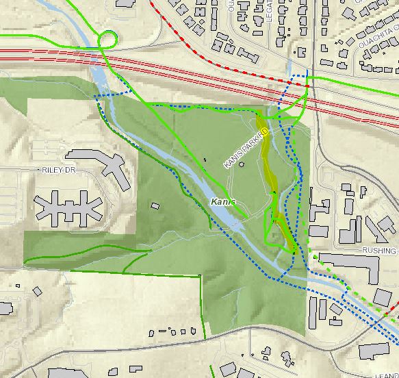
The Midline is a proposed east-west bicycle and pedestrian corridor through the heart of Little Rock. While a north-south trail connection through Kanis Park would ultimately be ideal for wayfinding and a pedestrian sense of place, existing trails and drives connect to the southeast edge of Kanis Park (Fig. 1). Sharrows and wayfinding signs in Kanis Park would help Midline users navigate from the Rodney Parham/Mississippi Crossing through Kanis Park to the Kanis-Boyle Connection.

Figure 1. This project would simply help Midline users navigate Kanis Park on existing facilities. Drives on which bicycle and pedestrian traffic would be mixed with vehicular traffic are thin white lines and existing trails are solid green lines (Master Bike and Trail Plans).
- Government
- Employment
-
Residents
- Citizen Services & Helpful Numbers
- 311
- Animal Services
-
BikePed Little Rock
- Why BikePed?
- Contact BikePed Little Rock
- Education
- Resources
- ATAC
- BFC Bronze June 2020
- BFC Bronze May 2016
- Complete Streets Policy Among Best of 2015
- BikePed Count
- Community
- Evaluation
- What Can I Do?
-
Projects
- Road Diets
- Safe Routes to School
- Projects Timeline
- Resurfacing
- Bike Parking
- Bike Lanes
- Lane Diet
- Trails & Sidepaths
- Emerging Bike Network
- Neighborhood Greenways
- Complete Streets Master Plan
- Board of Directors - Meeting Agendas
- FAQs: General
- Little Rock Identification Card
- Little Rock Marathon
- Online Payments
- Parks and Recreation
- Police Department
- Recycling
- Solid Waste Pickup
- Title VI Complaints
- District Courts
- Zoo
- Volunteer
- Flood Information
- Sustainability
- Business
- E-News
- City News
- Online Payments


 Trash & Recycling
 Online Payments
 City Documents
 Parks
Parks
 Traffic Court
 E-NEWS
 EXPLORE
 NEWS
NEWS
 TRANSLATE
