


 Trash & Recycling
 Online Payments
 City Documents
 Parks
Parks
 Traffic Court
 E-NEWS
 EXPLORE
 NEWS
NEWS
The Arkansas River Trail @I-30
The Arkansas River Trail is Little Rock's premier shared-use trail for recreation and transportation. It is advertised as a 15.6-mile trail loop, but it does not function in that way. Recreational riders tend to ride on the North Little Rock side of the loop, uncomfortable with several points on the Little Rock side.
The Arkansas River Trail at @I-30 is all off-street and perfectly safe. The problem here isn't safety but identity. Coming off the Clinton Bridge on the south side of the river, a rider is typically riding relatively fast due to the slope (Fig. 1). She needs to make a decision quickly about where to go to continue along the Arkansas River Trail. There are several choices (Fig. 2).
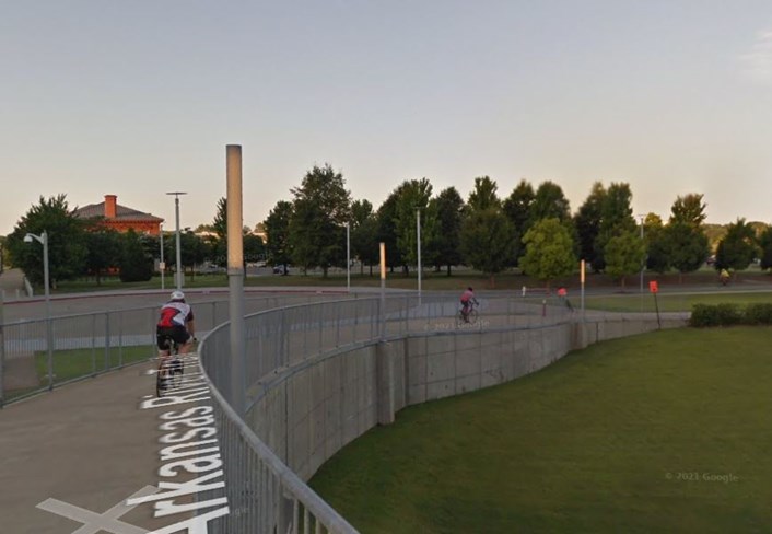
Figure 1. Riding down the Clinton Bridge, the rider cannot see the terminus of the bridge and must choose a path quickly.
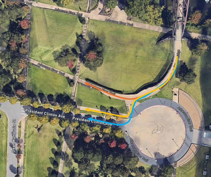
Figure 2. Taking the blue, yellow, or orange paths can all seem equally reasonable to stay on the Arkansas River Trail.
The Blue arrow puts the rider on a street typically devoid of traffic. The Yellow arrow puts the rider on an 8'-wide level concrete sidepath along Clinton Ave. The Orange arrow also puts the rider on an 8' wide concrete path, but it requires the sharpest turn off of the bridge and continues to slope down. The Orange arrow is the official Arkansas River Trail but can put fast-moving riders in conflict with pedestrians with little width to navigate.
The new I-30 bridge is much more open underneath than its predecessor (Fig. 3). It creates an opportunity to design an Arkansas River Trail that is wide and distinct from the other sidewalks around it.
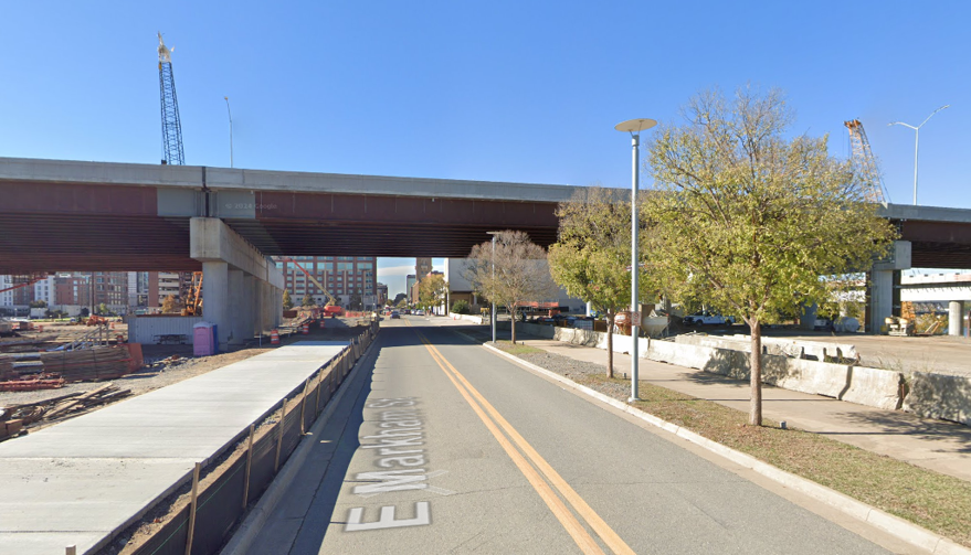
Figure 3. The new I-30 bridge is far more open underneath, creating an opportunity for a better Arkansas River Trail alignment.
